Annotated Bibliography of Related Print Resources:

The Once Upon a Time Map Book By B.G. Hennessey. Illus. by Peter Joyce. (2004). 16p. Candlewick Publishing Company, (0763625213).
This book chronicles the journey of Prince Charming and Cinderella as they visit six fairy tale kingdoms. With comprehensive maps of each kingdom, the reader is instructed to find specific points of interest and hidden objects using detailed routes and the illustrated map features.

There's a Map on My Lap!: All About Maps By Tish Rabe. Illus. by Aristides Ruiz. (2002). 48p. Random House, Inc.. (0375810994). Gr. 1-3.
The Cat in the Hat introduces readers to all kinds of maps- city, state, world, topographic, etc. With extended definitions at the bottom of each page, this book provides an excellent vocabulary reference. With colorful illustrations and rhyme, the Cat in the Hat defines the various parts of maps including the map legend, scale, cardinal directions, and grids.

Mapping Penny's World. By Loreen Leedy. (2000). 32p. Henry Holt and Co. (0805072624). Gr. 1-3.
After learning about maps at school, Lisa decides to create maps of all the places frequented by her Boston Terrier, Penny. From the yard to the park, this text provides maps with all of the necessary components and features. This book also illustrates the efficacy and purposes of mapmaking.

Are We There Yet, Daddy? By Virginia Walters. Illus. by S.D. Schindler. (2002). 32p. Puffin Publishing Company (0142300136). Gr. K-2.
On a road trip to Grandma's house, a son repeatedly asks his Father, "Are we there yet?" To which, his father consistently instructs his son to consult the map. With a repetitive refrain and engaging illustrations, this book also integrates math instruction as the 100-mile road trip is discretely diminished by 10 mile increments. The book includes the map as well as water color depictions of the changing countryside.

As the Crow Flies: A First Book of Maps. By Gail Hartman. Illus. by Harvey Stevenson. (1993). 32p. Aladdin Publishing Company (0689717628). Gr. 1-3.
This book chronicles and maps the favorite routes of a crow, an eagle, a rabbit, a horse, and a sea gull. With simple directions and basic map vocabulary, this book is tailored for early readers and serves as an original introduction to basic mapping concepts.
This book chronicles and maps the favorite routes of a crow, an eagle, a rabbit, a horse, and a sea gull. With simple directions and basic map vocabulary, this book is tailored for early readers and serves as an original introduction to basic mapping concepts.

Me On the Map. By Joan Sweeney. Illus. by Annette Cable. (1998). 32p. Dragonfly Books (0517885573). Gr. K-1.
This book illustrates the simplicity and comprehensive utility of maps, as a young girl locates herself within a crayon drawing of her room. The mapped area expands as she locates her room within the map of her house, her house on her street, her street in her town, etc. The area expands to a map of her country on the globe. The text also instructs readers how to identify their own location within each successive context.
This book illustrates the simplicity and comprehensive utility of maps, as a young girl locates herself within a crayon drawing of her room. The mapped area expands as she locates her room within the map of her house, her house on her street, her street in her town, etc. The area expands to a map of her country on the globe. The text also instructs readers how to identify their own location within each successive context.

Follow That Map!: A First Book of Mapping Skills. By Scot Ritchie. (2009). 32p. Kids Can Press (1554532744). Gr. K-3.
Sally and four of her friends utilize various types of maps and map symbols as they search the city, the country side, the globe, and the solar system for Sally's lost pets. Each page features a different type of map, including topographical, weather, and treasure maps. The reader must locate Max and Ollie, Sally's pets, on each map.
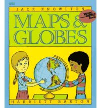
Maps and Globes. By Jack Knowlton. Illus. by Harriet Barton. (1986). 48p. HarperCollins (0064460495). Gr. K-3.
This book explores the purposes, history, and components of various maps. This text provides an excellent introduction to the basics of maps and globes, including legends, scale, latitude, longitude, grids, and the difference between physical and political maps.

Map Scales. By Mary Dodson Wade. (2003). 32p. Children's Press (0516277677). Gr. K-3.
Part of an emergent reader series on geography, Map Scales details the specific purpose of a distance scale on a map. The text differentiates map scales from the scales used for weighing and other purposes. The text also describes exactly how to use scales in estimating distance on a map.

Where Do I Live? By Neil Chesanow. Illus. by Anna Losa. (1995). 48p. Baron's Educational Series (0812092414). Gr. K-3.
This book describes location by beginning on a small scale and then expanding. Beginning within a child's room, the context successively increases to the location of the Earth in the Solar System. The text assists students in identifying their own respective locations on a map.
This book describes location by beginning on a small scale and then expanding. Beginning within a child's room, the context successively increases to the location of the Earth in the Solar System. The text assists students in identifying their own respective locations on a map.
