Day 5: Oceans and Continents
Objective:
The student will develop map skills by recognizing basic map symbols, including references to land, water, cities, and roads (1.4a)
Materials and Resources:
Giant Post-It Notes
Crayons
World Map
Globe
Blue Sheet/Carpet
Name Tags Labelled with Each of the Continents
Blank World Map
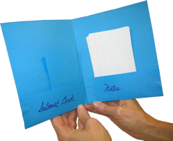
Construction Paper for Pocket Book Foldable
Crayons
World Map
Globe
Blue Sheet/Carpet
Name Tags Labelled with Each of the Continents
Blank World Map
Construction Paper for Pocket Book Foldable
Events of Instruction:
- Instruct students to work within their seating groups to draw a map of the world on a giant sticky note. The map should include a legend and compass rose. Students should use the crayons provided to color their maps.
- Allow each group an opportunity to present their world map.
- Gather students for whole-group instruction
- Discuss the symbols used on each map and the colors
- Using the globe, ask students to identify the areas represented by the color blue as well as the areas represented by the color green.
- Using the world map, note that the large areas of blue are oceans; the smaller areas are lakes and rivers. Indicate where each ocean is located. Ask students, "How many oceans are there?" "What are their names?"
- Explain to the class that there are seven continents. Define a continent as a large area of land. Ask "How many continents are there?" Review their names.
- Laying a blue sheet or carpet on the ground, explain that this sheet represents the world covered with water
- Select a volunteer and instruct him/her to stand in the upper corner of the carpet. Give this student a sign titled "North America." Have the other students greet North America. Ask, "Does anyone know why this continent is important to us?"
- Select another student and instruct him/her to stand in front of North America and hold hands with their classmate on the blue sheet/rug. Give the student a sign titled "South America." Have the students greet South America. Ask if anyone knows something about South America? Explain that North and South America are neighbors.
- Select a student to stand a few feet to the left of North America. Give this student a sign titled "Europe." Have the students greet Europe. Ask if anyone knows something about Europe. Explain that Europe is across the Atlantic Ocean from America.
- Continue to select and title students for Asia, Australia, Africa, and Antarctica. Situate them on the sheet accordingly. Europe and Asia should hook arms.
- Review each of the continents and oceans with the class.
- Instruct students to return to their seats.
- Instruct students to color the world maps on their desks. Land should be colored green and water blue.
- Students should then cut out each of the continents and oceans. Students should create a pocket-book foldable. One side of the pocket book should contain the oceans, while the other side contains the continents.
Differentiation:
- Students can refer to the class maps when creating the world map
- Groups should be organized, so that students who need additional support are paired with advanced students
- Students who finish their world maps early can attempt to label all of the oceans and continents on their respective maps
Assessment:
- Students will identify the way(s) water is distinguished from land on a map
- Students will create a map of the continents and oceans
- Students will color a world map according to land and water
Resources:
- Template for Pocket Book Foldable
